
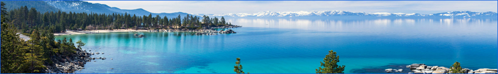
Alpine County
Alta Alpina 8 Pass Triple Crown Challenge
This route of nearly 200 miles and 20,000+ ft of climbing is the route for the new Alta Alpina Cycling Club's premier California Triple Crown event. The first 100 miles includes in order, east side of Kingsbury Grade, east side of Luther Pass, east side of Carson Pass, Blue Lakes Road and return to Turtle Rock Park. The second 100 miles would include in order, both sides of Ebbetts Pass, both side of Monitor Pass and the return to Turtle Rock Park.
Route Map
Blue Lakes Out and Back
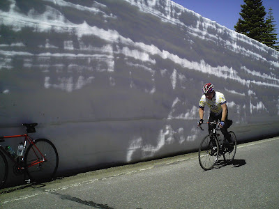
Since being paved a few years back, this has become one of the most popular rides south of Tahoe. Starting just off Hwy 88 avoids most all the traffic. Very scenic, smooth pavement and moderate climbs through Hope, Faith and Charity Valleys and up to Blue Lakes. In the summer there is water at Hope Valley Campground and at the campground up at Blue lakes. About 1500 feet of climbing out and back in about 24 miles. Do as many out and backs as you want. Don't miss Blue Lakes John on the left (see pic)just before the lakes!
Route Map
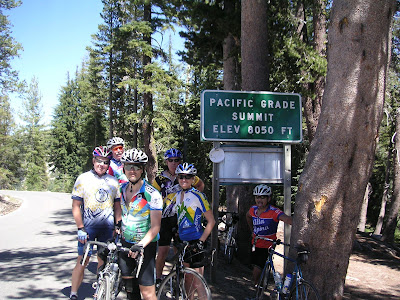
Double Monitor Pass Metric
This route is similar to the 2X Monitor Century but skips the flats and cuts to the climbing from the start at the corner of Foothill and Emigrant Trail. 67 miles and 7,200 ft of climbing up Emigrant Trail to Woodfords, over Turtle Rock Divide through Markleeville up and over both sides of Monitor and back to the start via Carson River Road. Food and water in Woodfords and Markleeville. Water at Turtle Rock Park and the bottom of the east side of Monitor.
Route Map
Ebbetts Pass Metric
Starting at the the Big Trees on the corner ofFredricksburg and Fairview in Carson Valley, this metric century heads up Carson River Rd. and climbs about 5000 feet through Woodfords and Markleeville to the top of Ebbetts Pass and back. There is water and food in Woodfords and Markleeville, water at Turtle Rock Park and during the summer, water at Silver Creek Campground part way up to Ebbetts Pass on the east side
.
Route Map
Hells' Kitchen Metric and Century
Starting at the top of Ebbetts Pass, descend to Hermit Valley, up Pacific Grade and over to Lake Alpine and Bear Valley where there is water and food seasonally. Continue west on Hwy 4 to Spicer Reservoir Rd. Turn left and follow to Spicer Camp and Boat Launch where there are toilets and water seasonally. Return past Stanislaus River Campground where there is pump water. At Hwy 4 make a left and go about 1/4 mile to a turn out at Hell's Kitchen Vista Point for a view of the Big Boulders. Return to Ebbetts via Hwy 4. Around 6000 feet of climbing. Good climbs into and out of Spicer. According to the Forest service link, there should be water at Spicer and at Stanislaus River Camp going into and out of Spicer Reservoir through October. Spicer Reservoir Want to make it a century? Start at Markleeville. Close 10,000 feet of climbing total.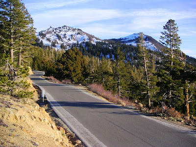
Route Map
Lake Alpine Out and Back Century
From the "Big Trees" along Foothills through Diamond Valley, to Hwy 89/4 in Woodfords. Through Markleeville, Hwy 4 over Ebbetts Pass and Pacific Grade to the Lake Alpine Store and return the same way including Diamond Valley. A good stiff but beautiful century with 9000 ft of climbing actually measured despite what MapMyRide shows. Water at Silver Creek Campground below the east side of Ebbetts is summer only. Bring plenty of food and water because the Lake Alpine Store has been closed a few times when it should have been open.
Route Map
Markleeville Metric
The Ever Popular Markleeville Metric provides a low traffic and scenic ride with about 63 miles and 3,500 feet of climbing. There are many short climbs all less than 1000 ft at a time and never too far from the start if the weather goes sour. Starting at the corner of Foothill and Mottsville (206 and 207) in Carson Valley the route includes Foothill Rd. Diamond Valley to Woodfords, 89 to Airport Rd. near Turtle Rock, in and out of Indian Creek Res. Campground, 89 to Markleeville, Grover Hot Springs and back, then through Markleeville and Diamond Valley to the Big Trees. This is an especially good early spring/late fall ride when snow prevents riding the higher passes.
Route Map
Markleeville/Lake Alpine Metric
If you like climbing on steep low traffic scenic mountain roads, this is the route. In 65 miles you'll climb about 7,100 ft over both sides of Ebbetts Pass and both sides of Pacific Grade. The west side of Pacific Grade will be the steepest. This is remote cycling. Depending on the time of year, the store at Lake Alpine may be open and there may be water at the campground there and at Silver Fork campground on the east side of Ebbetts. There is no water in Hermit Valley.
Route Map
Monitor Pass Loop Metric
Starting on Foothill Rd, this loop heads through the Ranchos to Hwy 395 and south to a food and water stop at Topaz Lodge. At the start of the Monitor Pass climb, there is a restroom and water. The views and descent off the west side of Monitor are the reward. Food and water can be found in Markleeville as well as Woodfords. Return via Carson River Rd and Foothill. This is great ride at 67 miles and 5,900 ft.
Route Map
Twice Over Monitor Century
For hardcore century hunters this one includes 8000+ ft of climbing starting right at Minden Park. This out and back route includes Hwy 88, Foothill Rd., Diamond Valley Rd., Hwy 89/4 to Markleeville and Hwy 89 twice over Monitor Pass. There are many places to get water on the west side including Woodfords, Turtle Rock Park and Markleeville. Mercifully, there is water and a restroom at the bottom on the east side of Monitor Pass.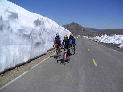
Route Map
Wild Sierra Century 2010
. Start/Finish at Turtle Rock Park . 101 miles . 12000 feet of climbing From Turtle Rock Park, descend to Woodfords and Carson Valley via Diamond Valley Rd. Then along the base of the mountains for the 1st climb....Kingsbury Grade on good pavement and wide shoulder. Return to Turtle Rock Park via Emigrant Trail to Woodfords. Now a nice little out and back....over Monitor Pass and to the bottom in Antelope Valley....turn around and head back to Markleeville for the second ascent of Monitor. This is a tough century on some of the most popular Alta Alpina routes. There is full support during the club's Wild Sierra Event in June. At other times, there is water at the bottom of the east side of Monitor, food and water in Woodfords and Markleeville.
Route Map