
Club Road Races - Venues
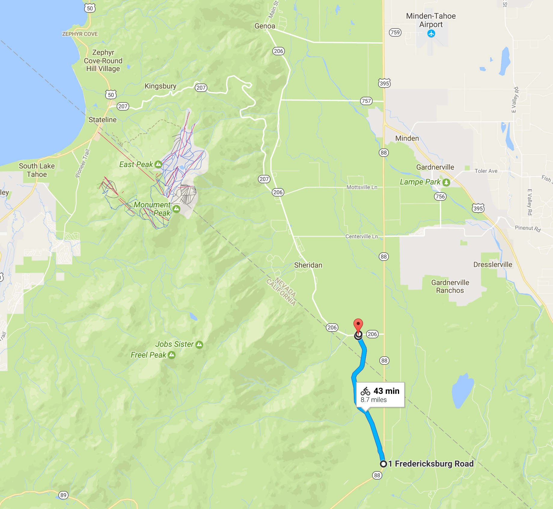
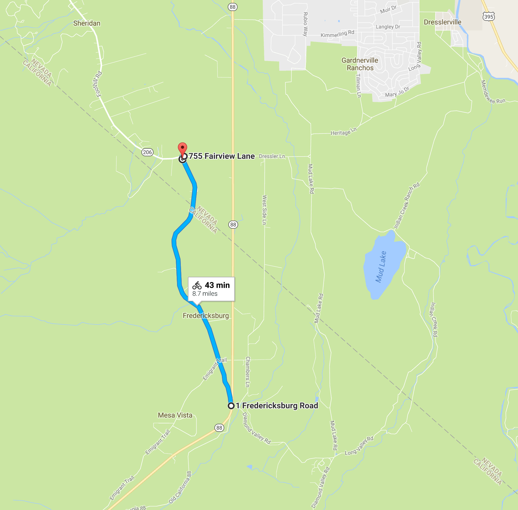
Fredericksburg
Take Hwy 88 south. Turn RIGHT onto Fairview Lane (SR 206). LEFT on Fredericksburg. Start and Finish will be at Fairview and Fredericksburg.The course is a rolling road and runs approximately 4.3 miles to the turnaround near the intersection at Hwy 88 for a round trip of approximately 8.7 miles.
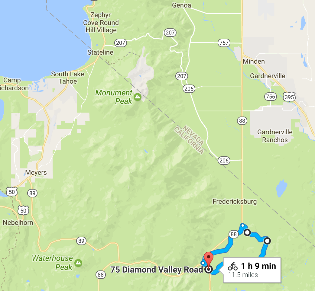
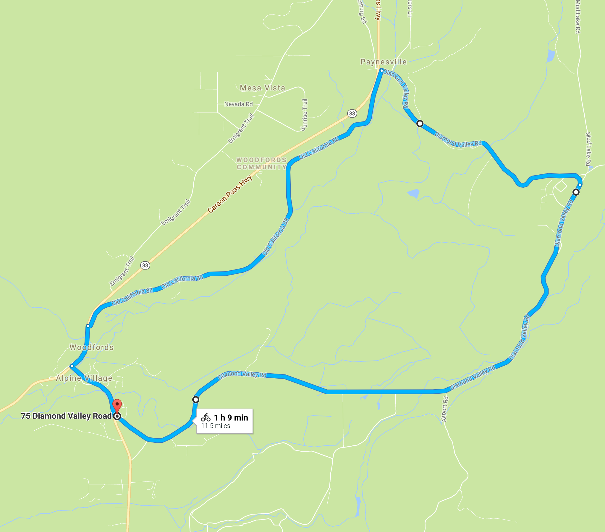
Diamond Valley
South on Hwy 88 to Woodfords. Turn LEFT onto Hwy 89 towards Markleeville. At the top of the first hill, turn LEFT onto Diamond Valley Rd. Park in either community development or pubic health parking lots.The course is a clockwise loop of approximately 11.5 miles with 2 main climbs each of less than 1 mile. The race starts from the community development parking lot and finishes on Diamond Valley Rd. near the volunteer fire department.
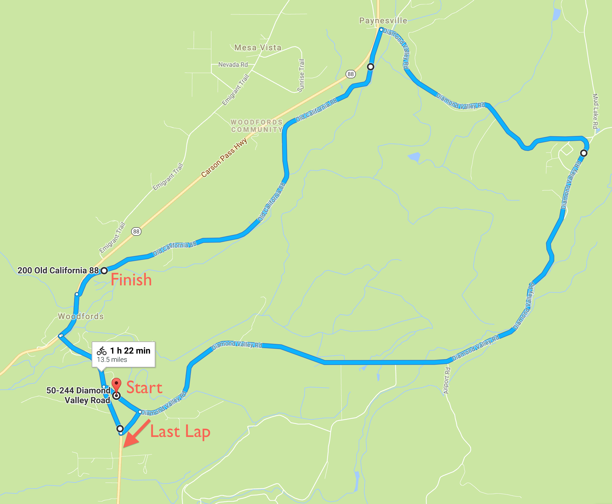
Double Back Course
The course is a variation on the standard Diamond Valley course in which racers take their last lap backwards and finish near the top of Carson River Rd. Near the end of their penultimate lap, racers turn left after passing the elementary school, turn right onto Hwy 89, and right again onto Diamond Valley Rd..
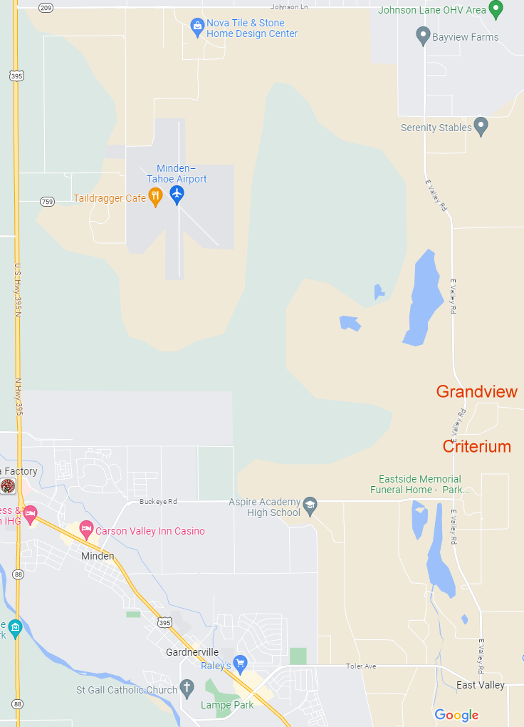
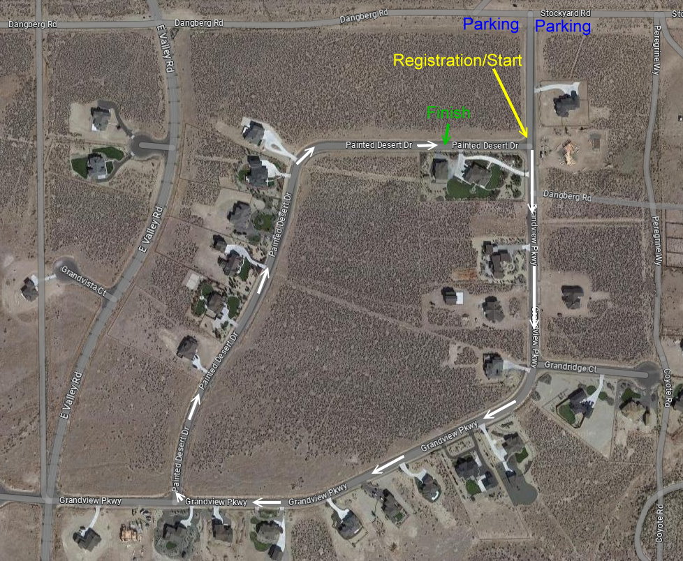
Grandview
From Hwy 395, make your way over to East Valley road via Johnson Lane, Buckeye, Waterloo/Toler, or Pinenut roads. Travel up to the Grandview estates midway along the East Valley time trial route. Park up at the North East corner of the venue along Stockyard road away from any residence's road frontal areas.The course is a clockwise loop of just over 1 mile with 4 sharp right turns.
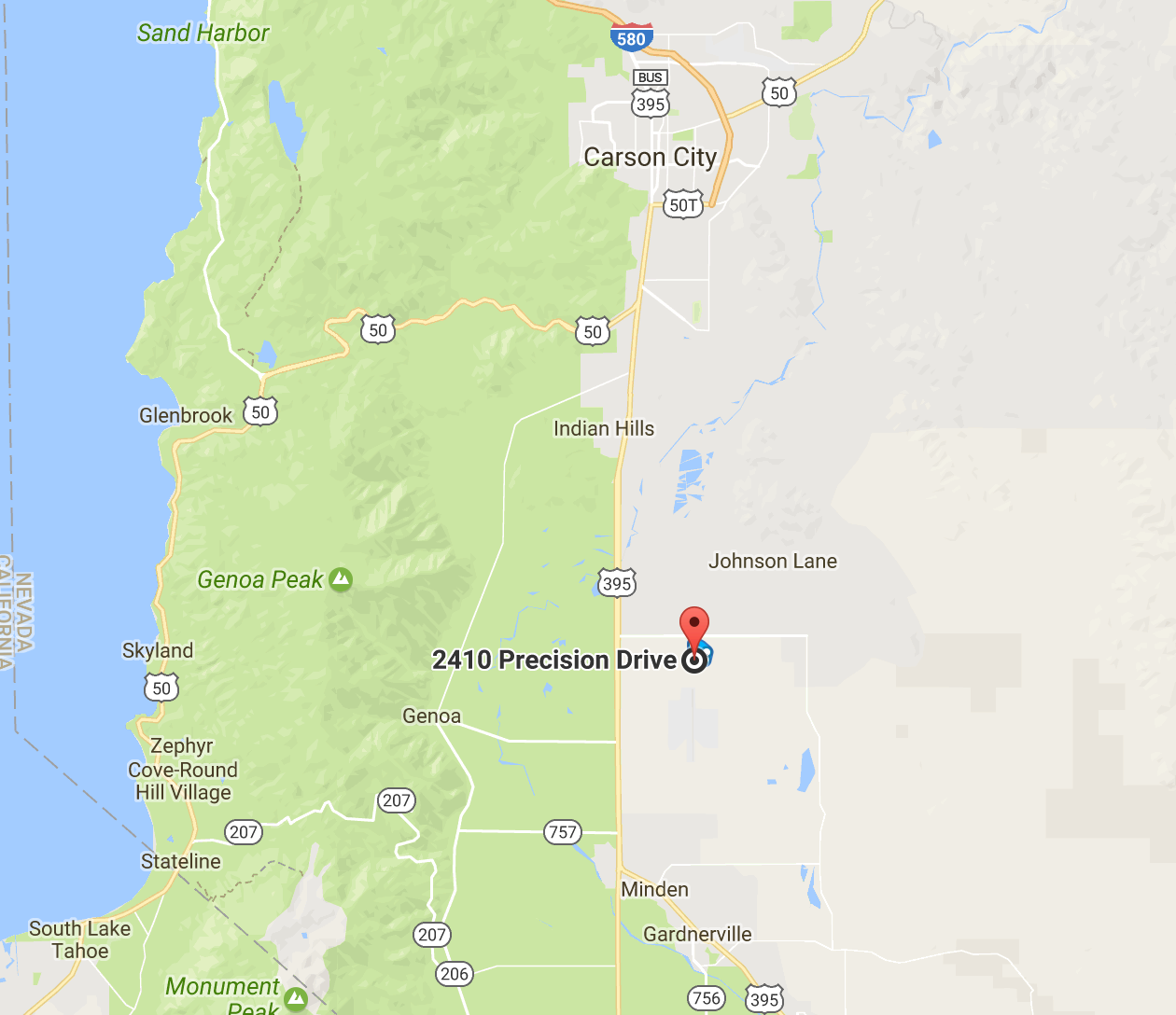
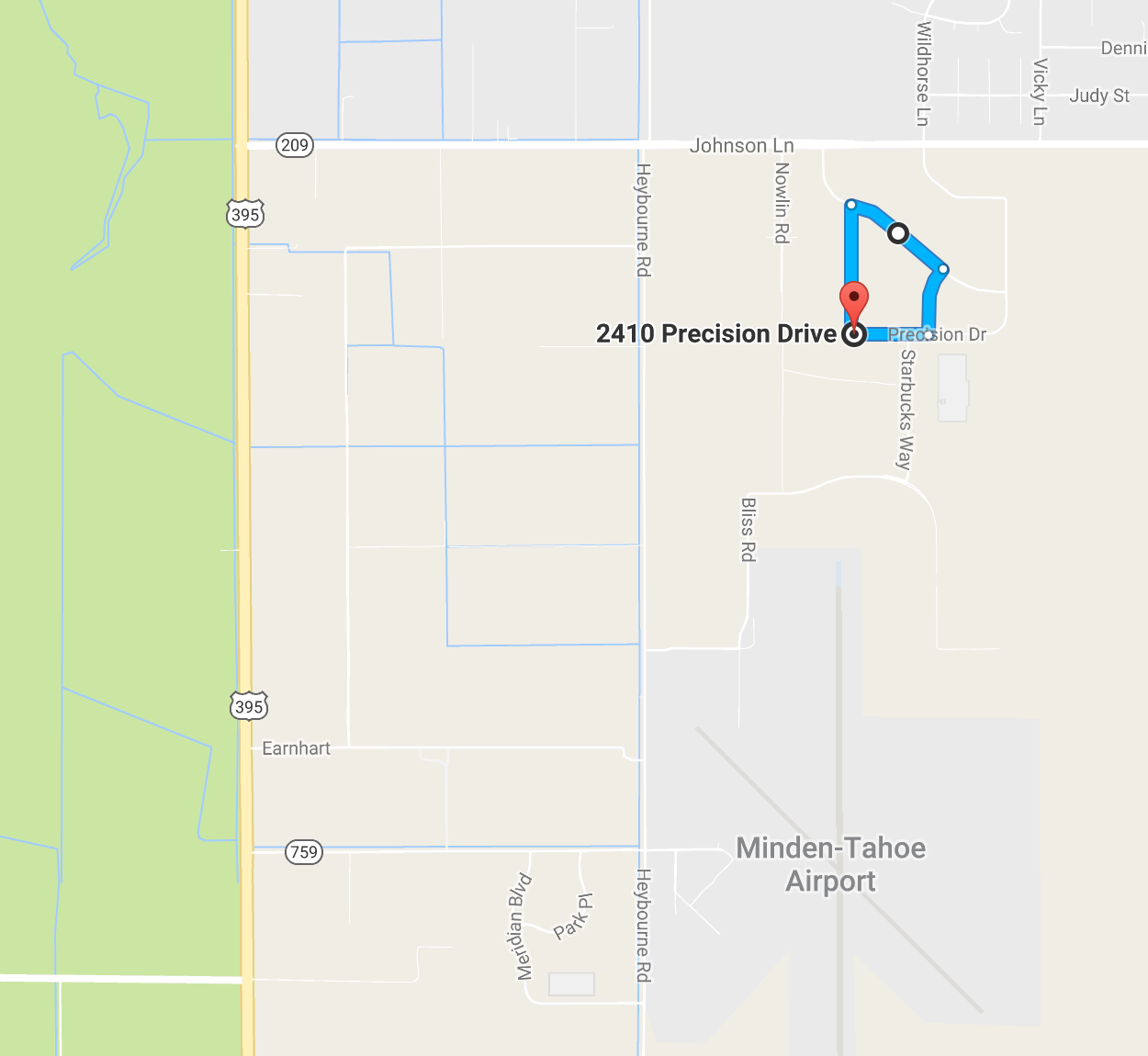
Starbucks
Hwy 395 North from Minden or South from Carson City then East on Johnson Lane. Turn RIGHT on Business Pkwy. then RIGHT again on Silver State Pkwy. to end.The course is a clockwise loop of just less than 1 mile with 4 sharp right turns.
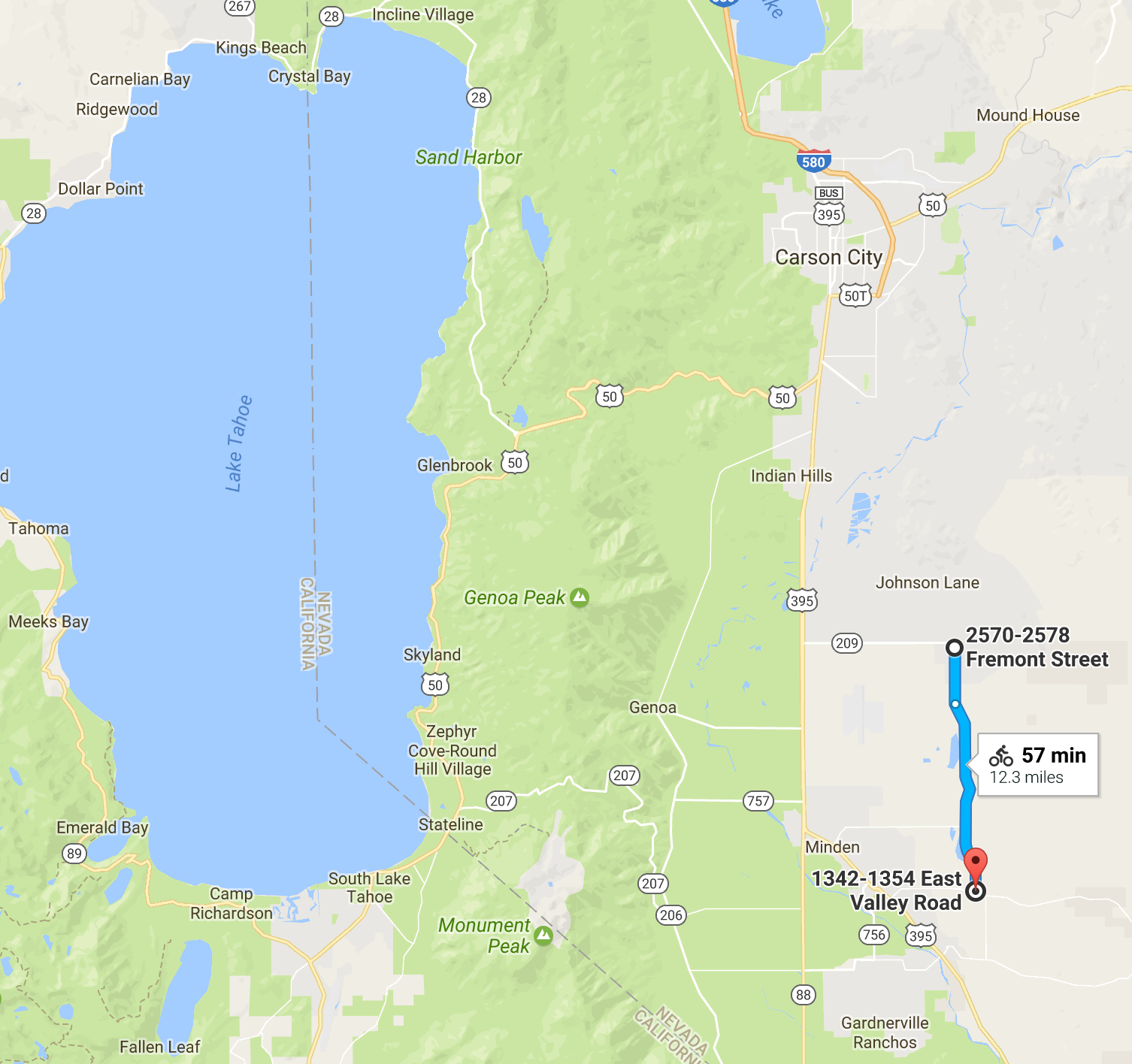
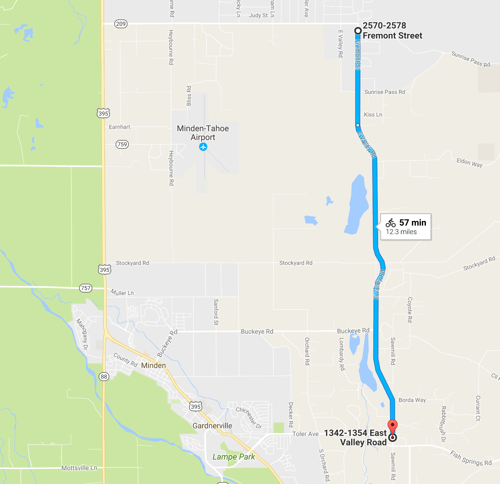
East Valley
From Hwy 395 and Waterloo Lane in Gardnerville (Walgreens and Taco Bell) head EAST on Waterloo which becomes Toler and then becomes Fish Springs. After 2.2 miles turn LEFT onto East Valley Rd. then turn RIGHT onto Solitude. Park off the road and avoid driveways. Do not block traffic. Start and Finish will be at East Valley and Solitude.The course follows East Valley Rd. which is largely flat and exposed to the wind. It runs approximately 6.1 miles to the turnaround near the intersection at Johnson Lane for a round trip of approximately 12.3 miles.
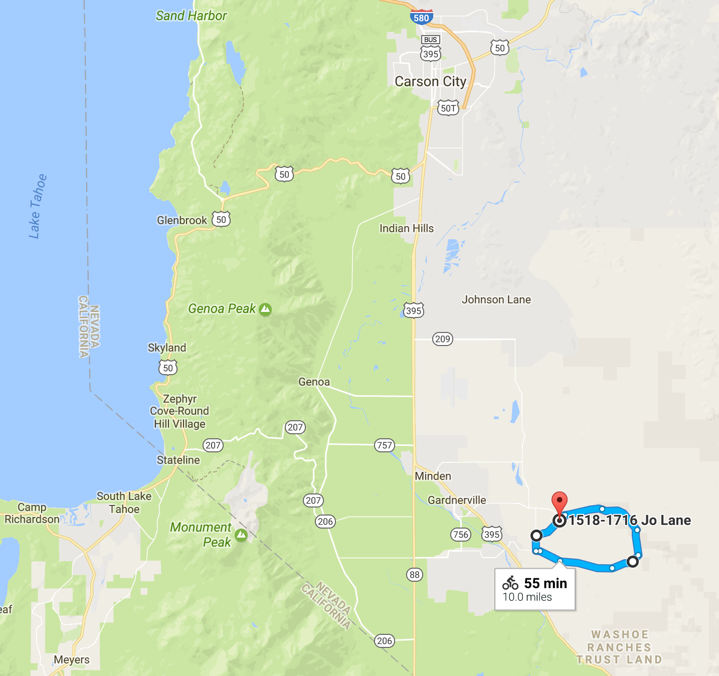
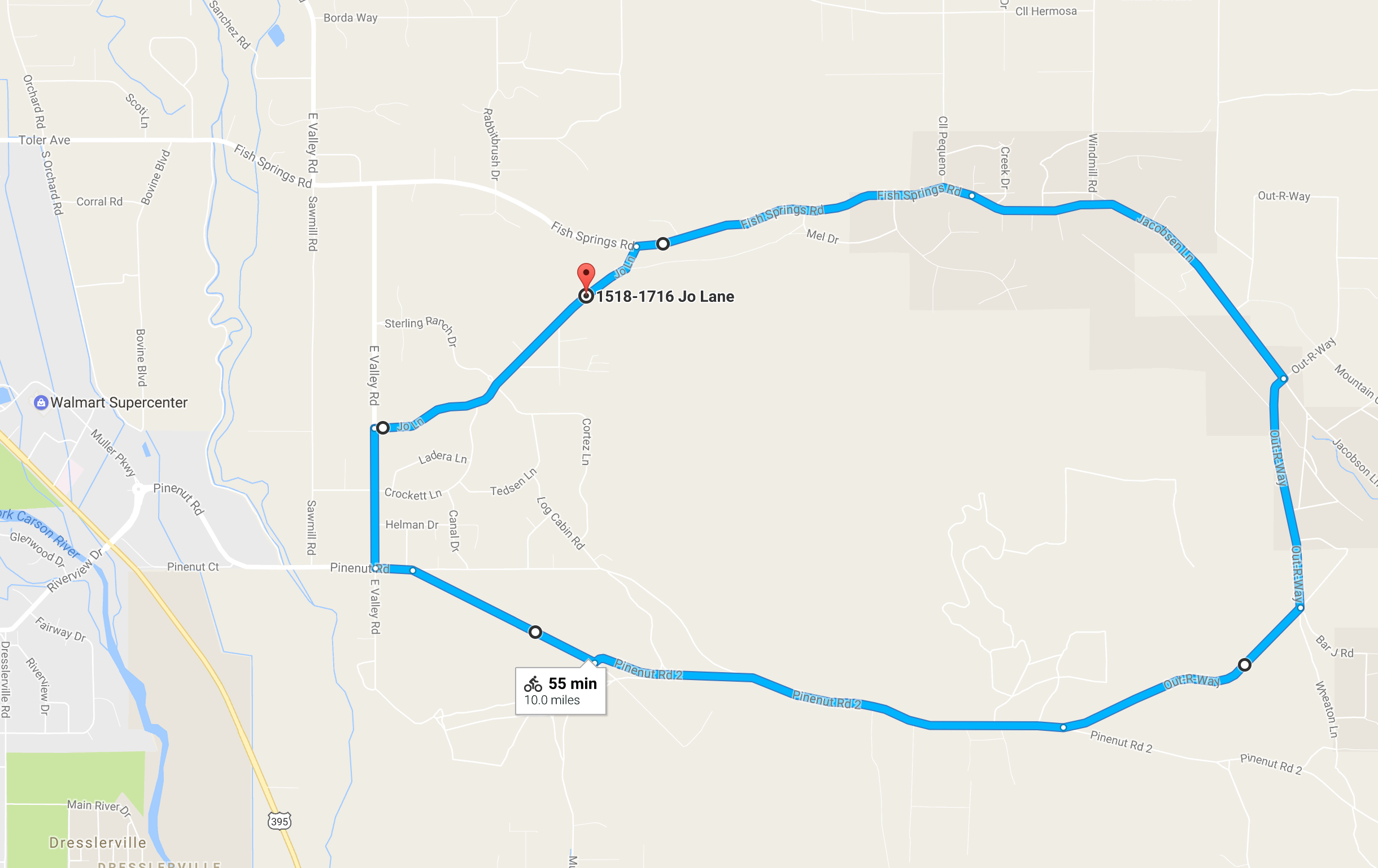
Pinenut
From Hwy 395 and Waterloo Lane in Gardnerville (Walgreens and Taco Bell) head EAST on Waterloo which becomes Toler and then becomes Fish Springs. After 3.6 miles turn RIGHT onto Jo Lane. Drive about a quarter mile and park off the road in the dirt. Do not block driveways.The course is a clockwise loop of approximately 10 miles with some small climbs.
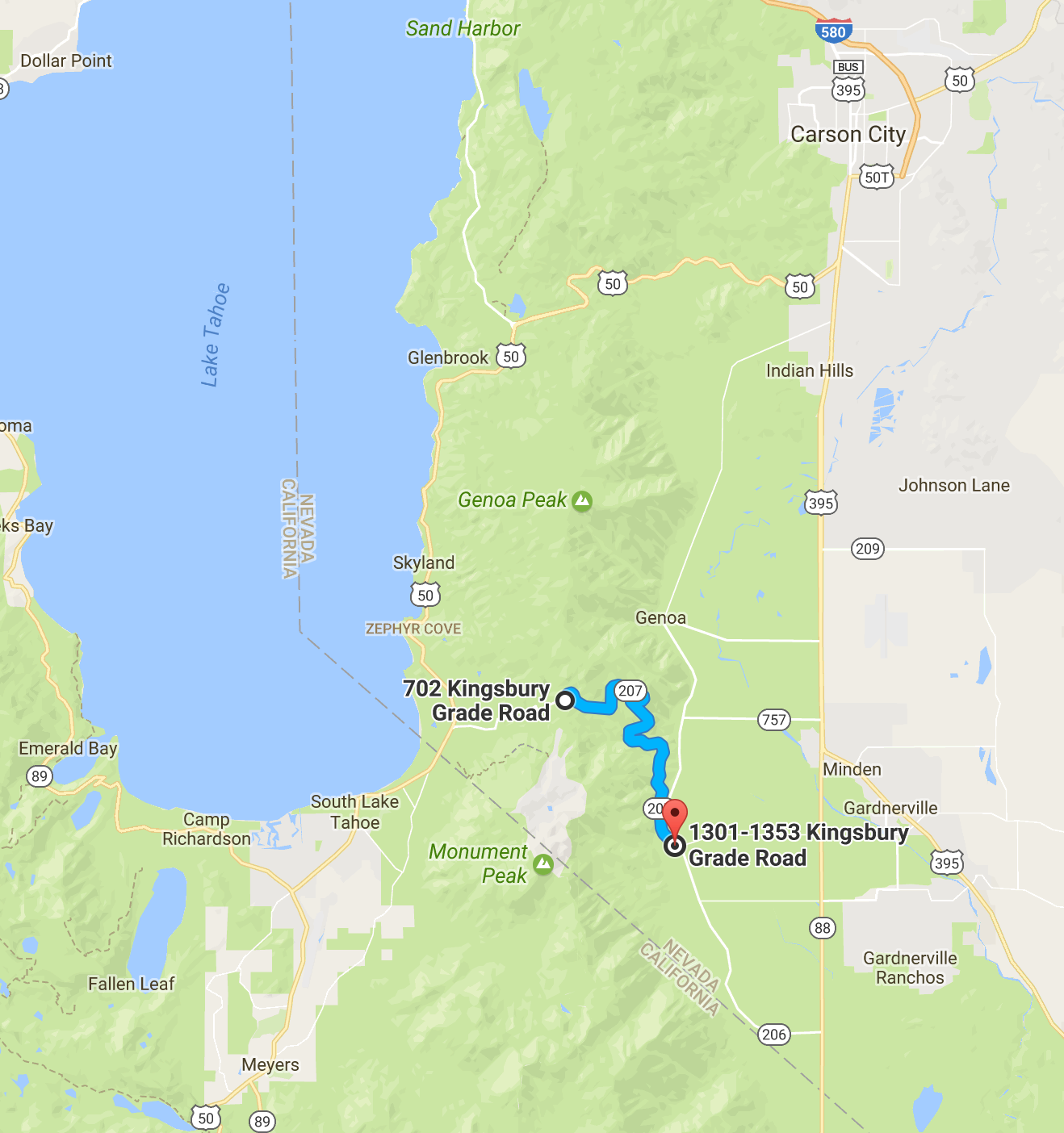
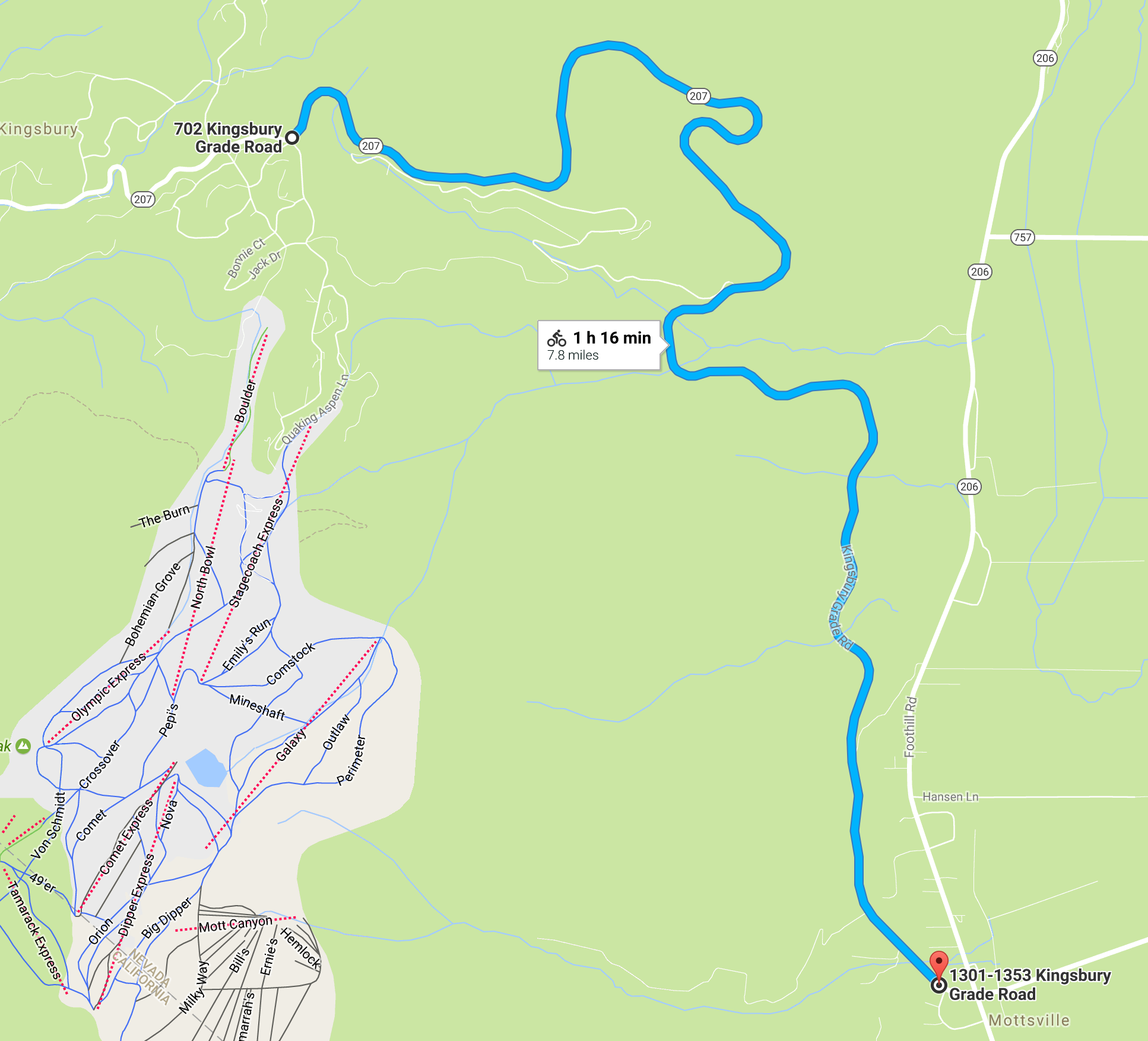
Kingsbury
Park in the park-and-ride area at the base of Kingsbury Grade (intersection of NV206 and NV207).The race is a climb of approximately 7.8 miles and ends just before the summit marker.
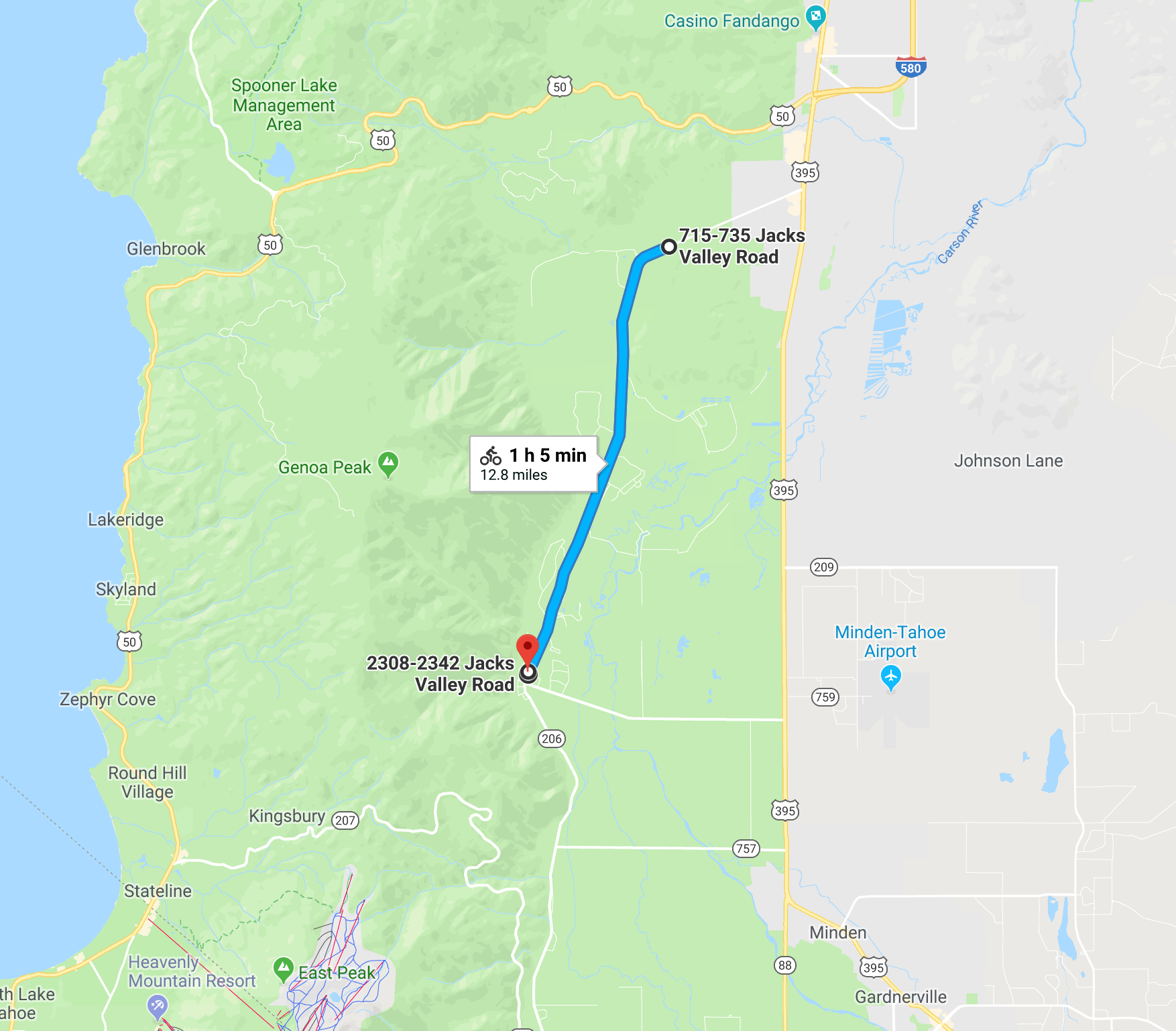
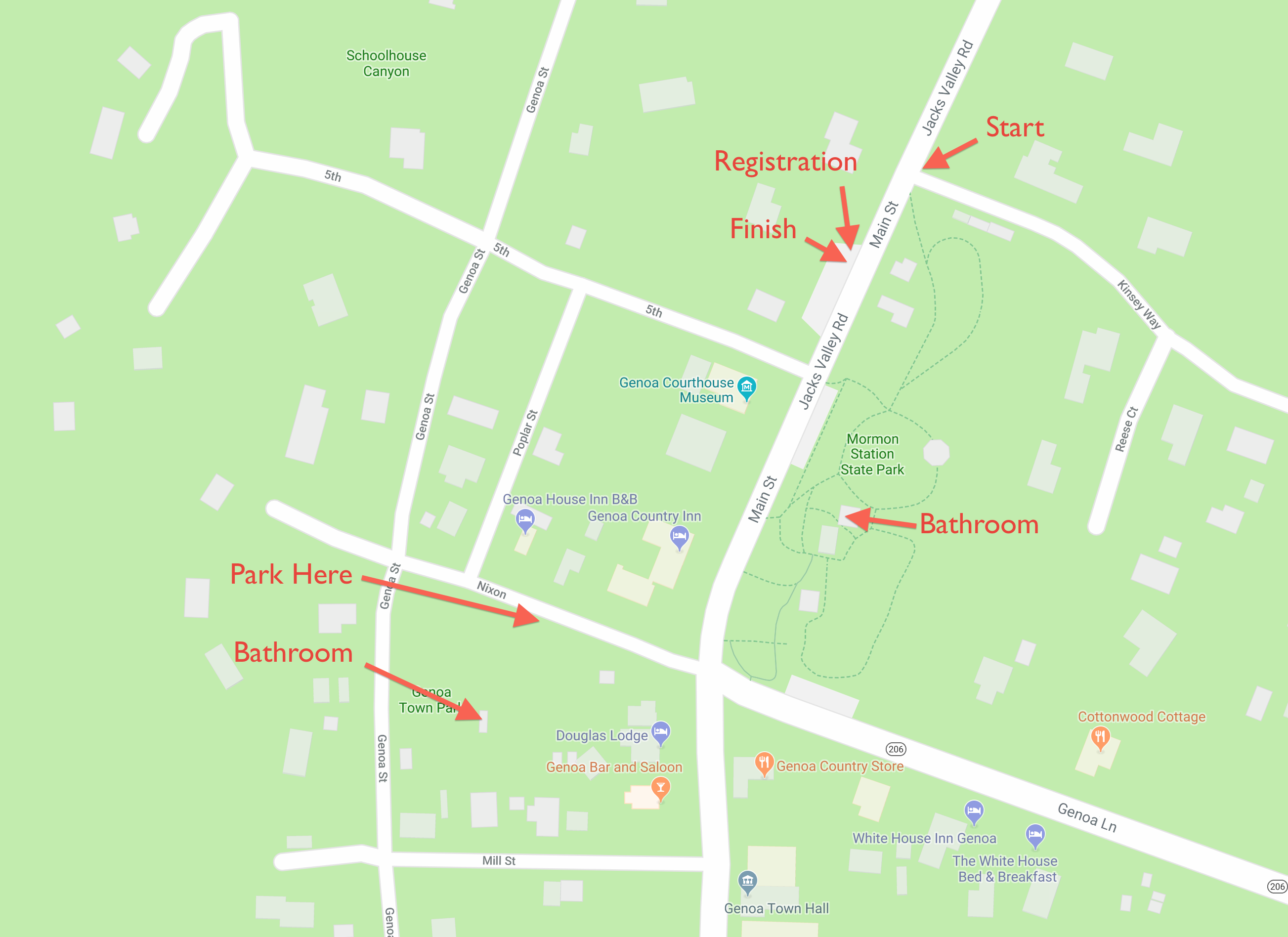
Jacks Valley
The start and finish are in the town of Genoa so facilities are a little more distributed.Important: Park at Genoa Town Park on Nixon St. Please do not park at Mormon Station Park, on Jacks Valley, or on Kinsey Way. Please make a point of coming to a full stop at all stop signs in Genoa. There are bathroom facilities both in Genoa Town Park and Mormon Station Park. The race starts at the corner of Jacks Valley and Kinsey Way.
The course follows Jacks Valley Rd. which features a series of gentle climbs. It runs approximately 6.4 miles to the turnaround midway between the Jacks Valley Fire Hall and the Clear Creek Trailhead (at a pull-out on the North side of the road) for a round trip of approximately 12.8 miles.
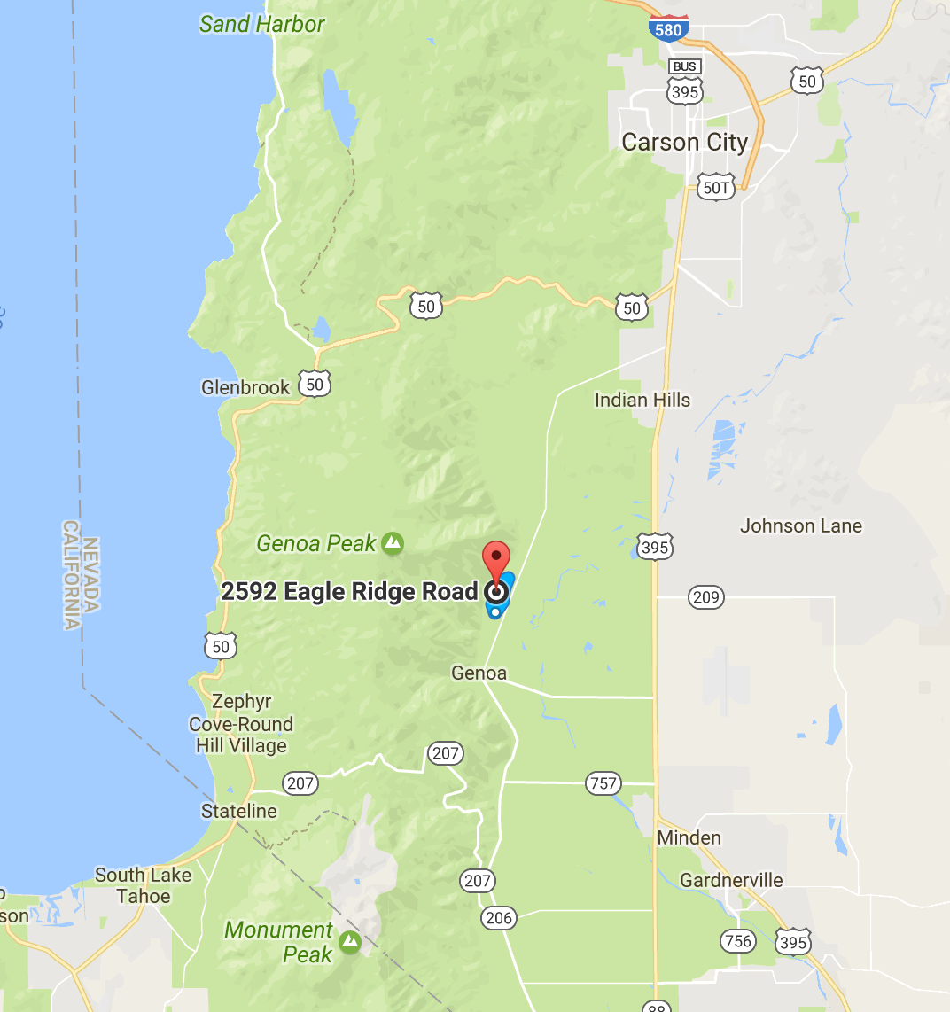
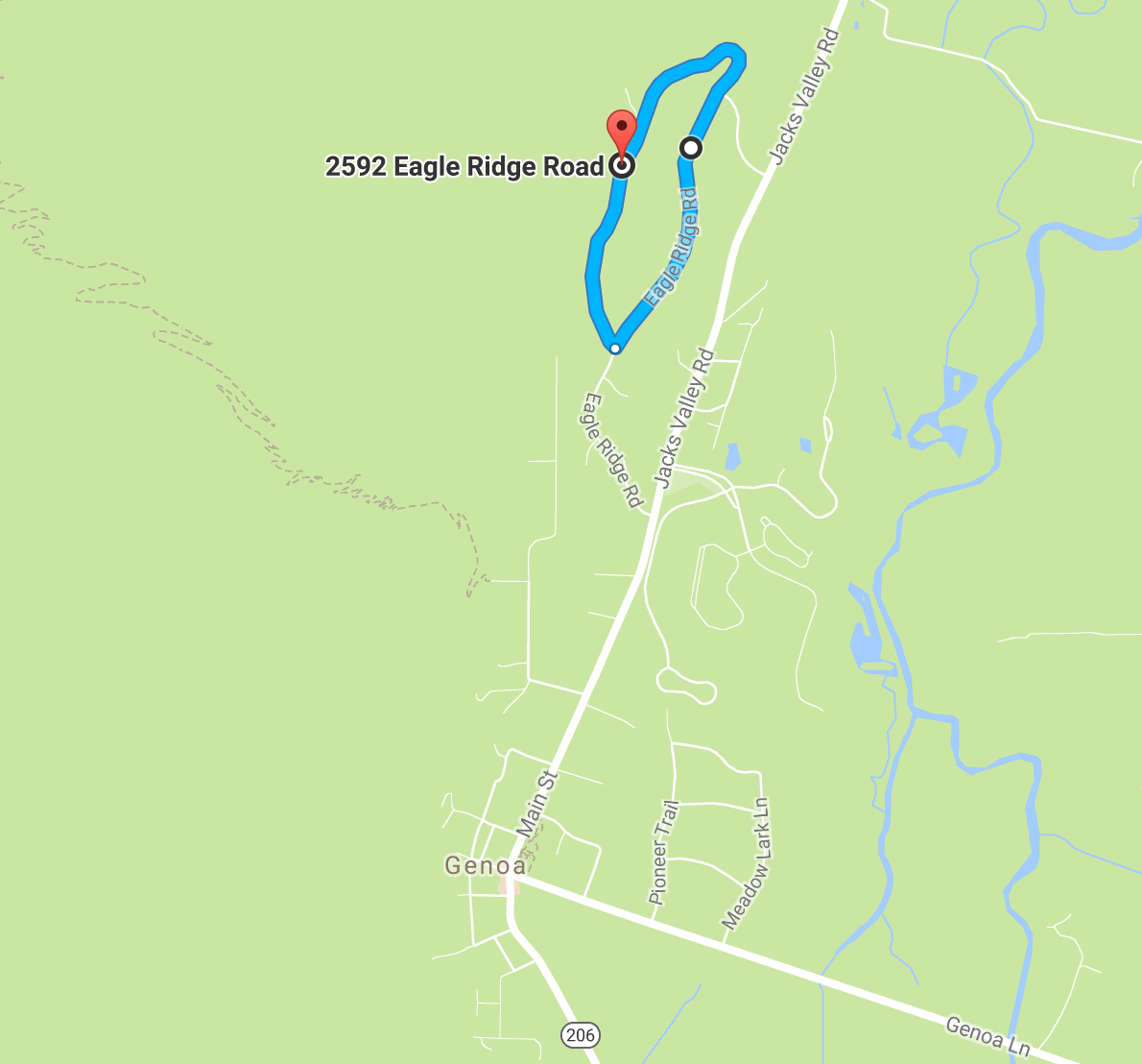
Eagle Ridge
North on Jack's Valley Road from Genoa. After 0.9 miles turn LEFT onto Eagle Ridge Rd. and drive 0.5 miles to corner of race loop. Park off the road either at the top or bottom of hill. Start and finish is at the top of the hill.The course is a 1.7 mile loop with a significant climb and descent and two sharp turns.
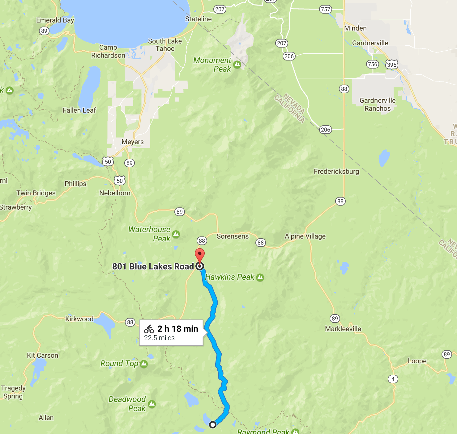
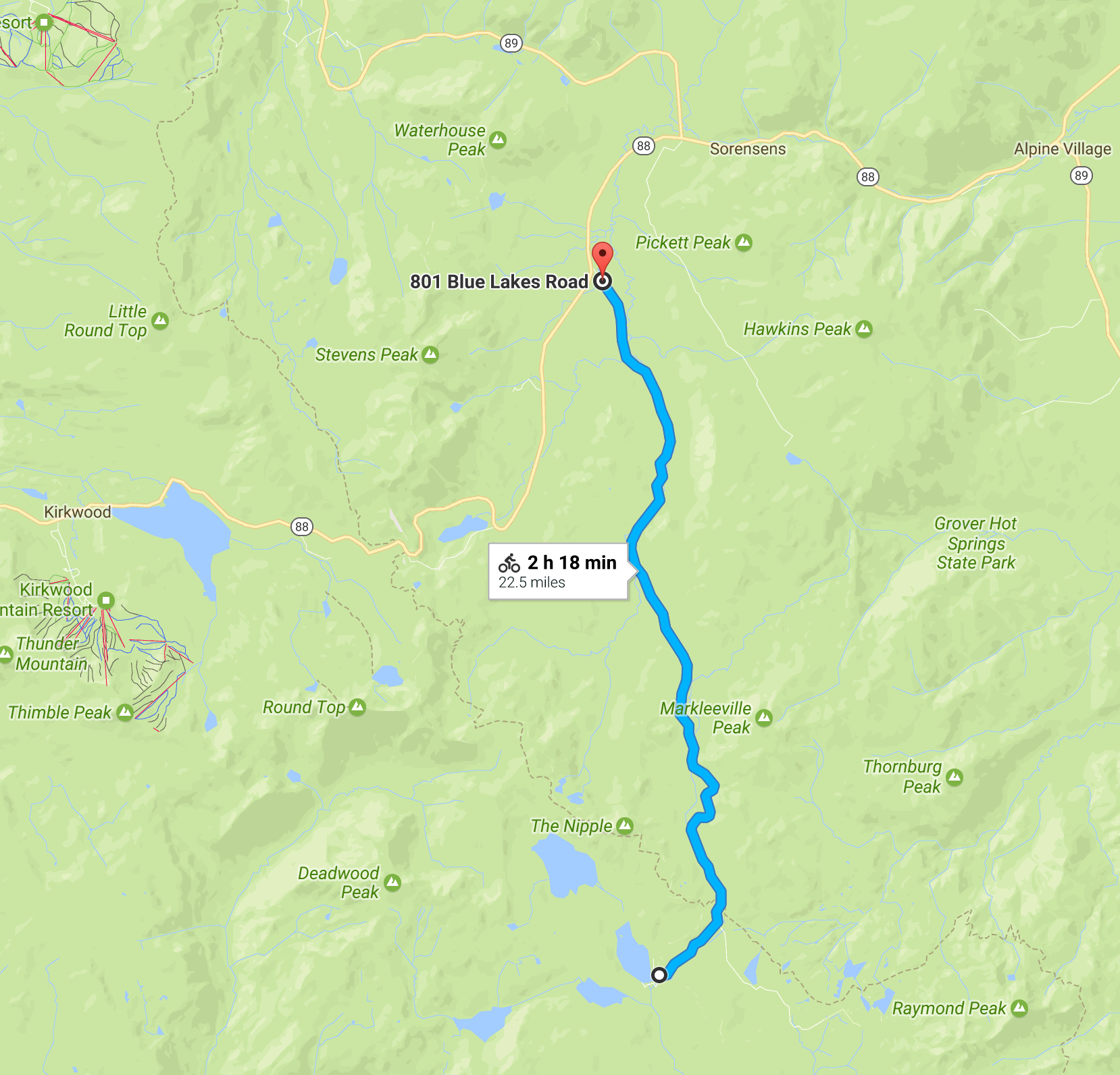
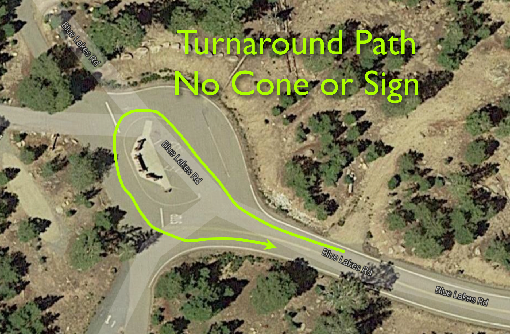
Blue Lakes
West on Hwy 88 towards Kirkwood. 2.5 miles west of Pickett's Junction (intersection with Hwy 89 North) turn LEFT onto Blue Lakes Road. Drive 0.2 miles and park in or near the USFS rest area on the right.The course follows Blue Lakes Rd, in a series of climbs, approximately 11.2 miles to the campground at the end where racers go around the sign boards to turn around and return (there is no sign or cone--see diagram below).
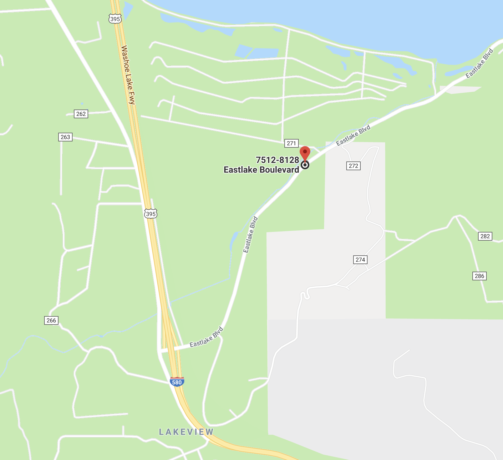
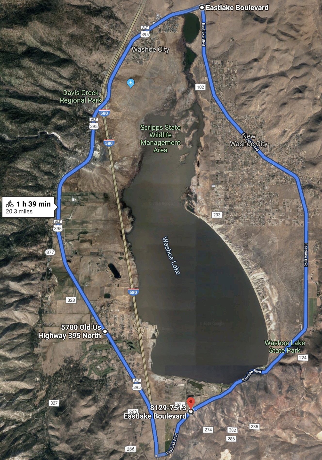
Washoe Valley
The start/finish is the very large pull-out on the north side of Eastlake Blvd 1.1 miles east of US395.The route is a 20.3 mile clockwise loop of Washoe Valley. The route heads west on Eastlake, turns right on US395 going north, passes Bowers Mansion, crosses over I=580, passes the Chocolate Factory, turns right on Eastlake Blvd going south for the final 9.2 miles to the finish.
This page last changed May 1, 2023 jw